visitor Impact
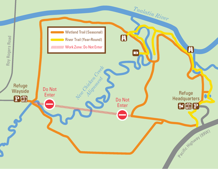
Due to active construction and movement of heavy machinery that will resume in the restoration area, effective August 16th, the Seasonal Wetland Trail will close and remain closed through the normal seasonal closure (see map below). The Seasonal Wetland Trail will reopen May 1st, 2022. The Year-Round River Trail will remain open throughout construction.
Key Dates
Summer through Fall 2021:
Relocation of fish and mussels to prepare for the diversion of the creek channel.
The removal of water control structures and installation of two new bridge crossings near the wayside and photo blind.
This project will conclude in the fall of 2021, when the flow from the current Chicken Creek will be diverted into the excavated creek channel that was created in phase 1.
Fall 2019 through Winter 2020:
In addition to the large scale plantings conducted by our community partners, the Refuge hosted a few community planting events. During these events, volunteers planted mostly woody riparian species.
Summer 2019
The project began with the delivery of large woody debris used for habitat improvement in the creek channel and its associated floodplain. Portions of the Wetlands Seasonal Trail (pictured below) were permanently closed. This portion of the old trail was removed to connect the new 280-acre wetland site. The new section of the trail opened in mid-July of 2019, which provided access to a previously closed area of the Refuge and added an overall 1/2 mile of trail. This is a permanent change to the Refuge trail system. The new creek channel was excavated, some of the ditches were filled in, and woody debris was placed throughout the site.
Why return the creek to a curving flow?
Over 100 years ago, when this land was converted to agricultural use by Europeans, the portion of Chicken Creek that once meandered through the present day Refuge before it met the Tualatin River, was altered to become a straight channel, and reduced in length from 2 miles to 1/2 mile. While this allowed farmers to effectively manage the land for crops and dairy cows, it greatly reduced habitat for fish and wildlife.
When the area became a National Wildlife Refuge in 1992 the process of rehabilitating the landscape began. The land that is now referred to as the Atfalat’i Unit was divided into multiple wetland impoundments that, to date, have been intensely managed by water control structures and intricate water delivery canals in an attempt to mimic naturally functioning wetland systems. While this work has represented a positive first step for wildlife and people alike, Chicken Creek has remained in its unnatural straightened channel, as it did over a century ago, to the detriment of native aquatic species, floodplain wetlands, and Tualatin River water quality.
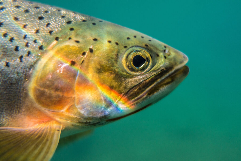
The faster flows in a straight and shortened ½ mile channel have limited rearing and resting opportunities for native aquatic organisms like cutthroat trout and western brook lamprey, compared to the slower flows of the meandering 2 mile natural creek system that once existed. Further, some of the water control infrastructure present barriers to habitat further upstream of the Refuge. Faster flows in a straight channel have also caused significant erosion of the current channel, preventing the creek from spilling onto its floodplain, while carrying copious amounts of sediment directly into the Tualatin River, creating water quality concerns associated with increased turbidity. By restoring the Creek’s natural curves for over 2 miles across the floodplain, and eliminating water management infrastructure, Chicken Creek will once again serve as the lifeblood of its floodplain. All the while greatly reducing the need for human intervention to sustain the thriving system.
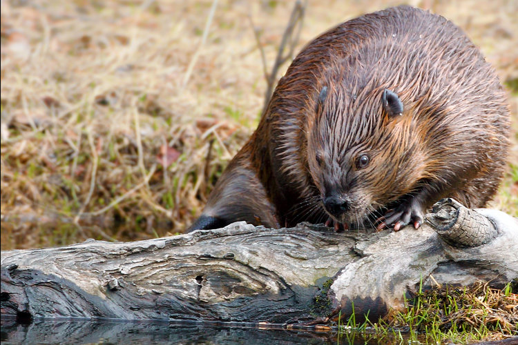
Beaver activity will cause water to pond, leading to a lush, diverse wetland and riparian habitat along Chicken Creek and throughout the project area.
partners in conservation
A project of this size requires the help of many beyond our Refuge staff, including wildlife. Refuge biologists and experts from our community partners anticipate some help from nature’s #1 engineers, the North American beaver. The restored riparian vegetation and meandering waters of Chicken Creek will entice beavers – who can’t resist the sound of flowing water – to become even more active in the area than they already are. Dam building will cause water to pond throughout the 280-acre site. As a result, wetland and riparian vegetation will thrive and a diverse array of fish and wildlife will benefit from more foraging, nesting, and protection opportunities.
From research, to know-how, to financial support, we also have many human partners to thank for this project becoming reality: